
Project team: Chanakan Chormai, Soundouss Aboussekhra, Teodora Popescu, and Kailshree Gadani
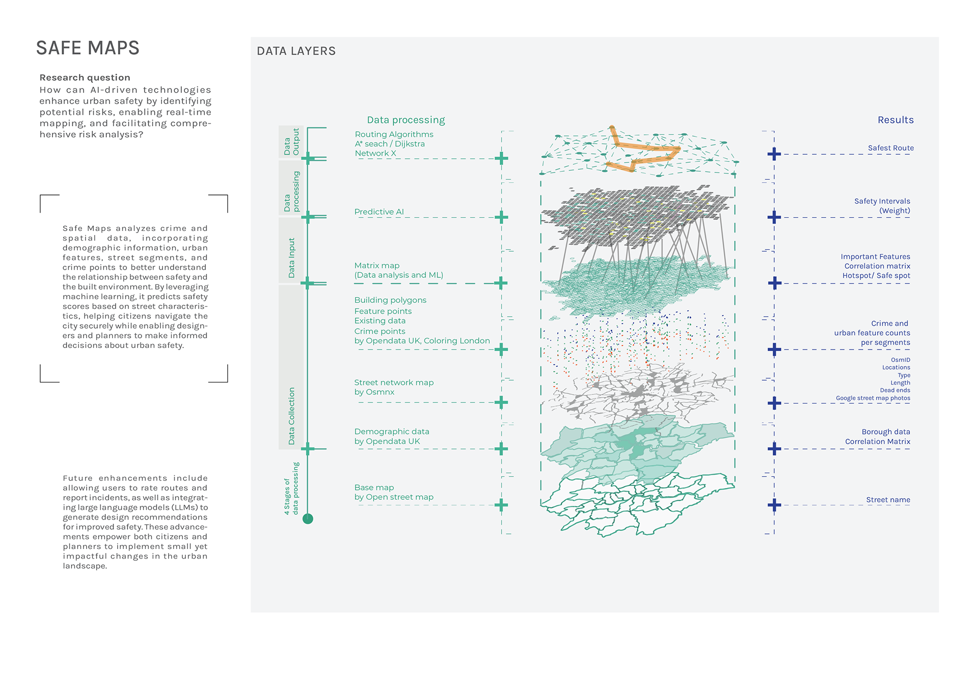
Safe Maps is an AI-powered web application that places citizens' safety at the heart of urban design and navigation. By analyzing crime and spatial data across London, the platform uses machine learning to predict safety scores based on street characteristics, helping citizens navigate the city securely while providing urban planners and designers with data-driven insights for safer urban environments.
The project combines multi-scale urban data analysis, predictive modeling, and user-centered design to create personalized routing solutions. Through comprehensive analysis of 30 urban features across neighborhood, building, street, and point scales, SafeMaps identifies correlations between urban characteristics and safety patterns, enabling both proactive city planning and real-time citizen support.
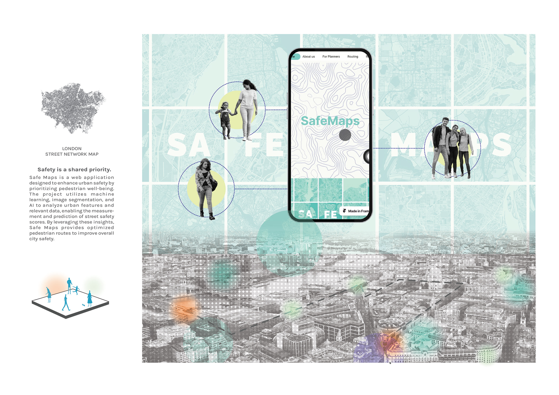
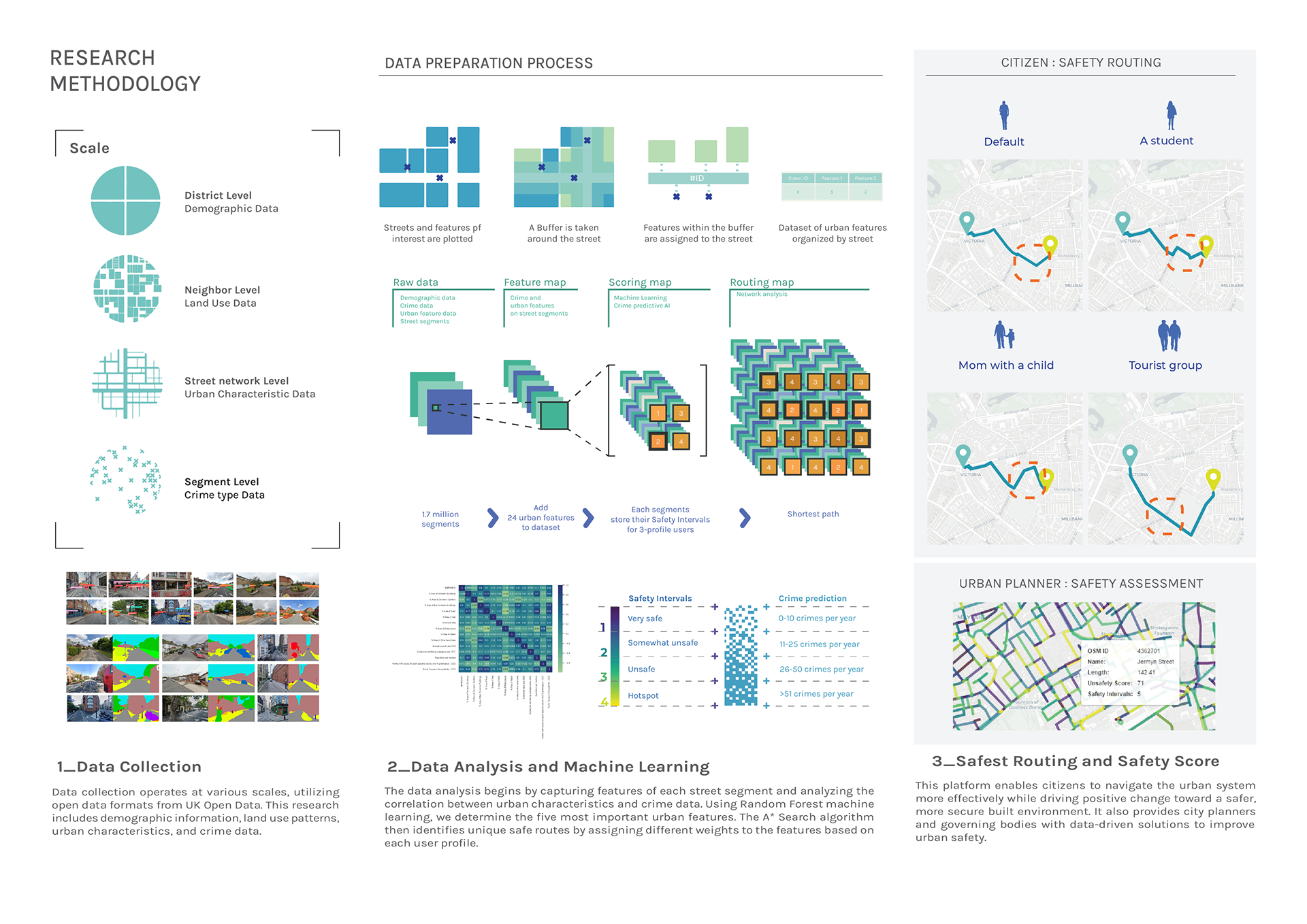
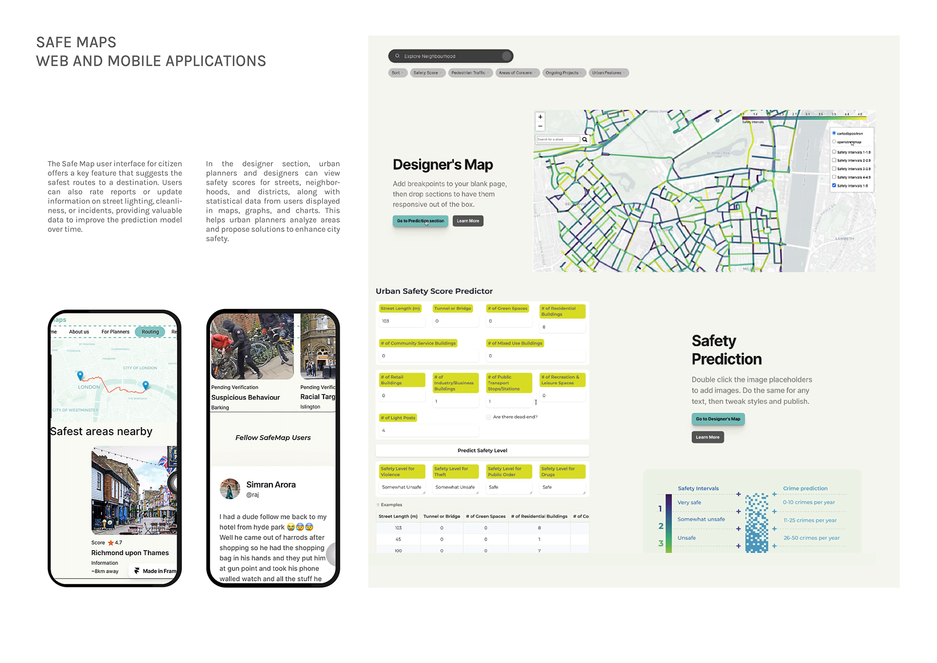
The platform serves dual purposes: providing urban professionals with evidence-based tools for safety-conscious design decisions, and empowering citizens with safe route recommendations tailored to different user profiles (students, families, tourists). Future developments include citizen reporting features and AI-powered design recommendations, creating an active feedback loop between community engagement and urban policy development.
This citizen-centered approach transforms passive safety data into active community engagement, creating feedback loops that inform both individual navigation decisions and broader urban policy development.